Major Cities
Diverse Geography
Religions
GEOGRAPHY
The Indian subcontinent occupies the southernmost part of the continent of Asia. It shares its borders with Pakistan in the Northwest, Nepal, Bhutan and China in the north, Myanmar to the east, the Arabian Sea along its west coast and the Bay of Bengal to its Southeast except where Bangladesh interrupts this coastline. (Please refer to the maps below).
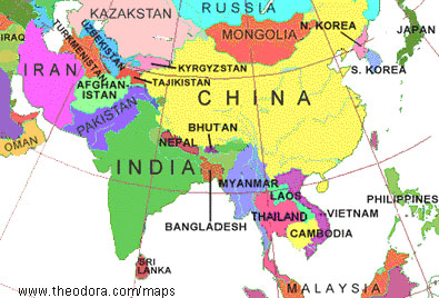
Map courtesy of www.theodora.com/maps, used with permission
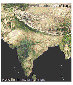
Map courtesy of www.theodora.com/maps, used with permission
Where the landmass of India joins the rest of Asia, the mountain ranges of Himalayas rise; this mountain-forming process is still continuing and is the result of the landmass of India thrusting northward into that of Asia. Scientists have proof that approximately 50million years ago the Indian landmass separated from the super continent “Gondwanaland” and moved northwards until it made contact with Asia. The peculiar location of India is responsible for the varied ecology in this land; from the temperate north to deserts of Rajasthan, to the mangroves of Bengal, to the Deccan plateau and the very long coastline.
BIOSTATICS:
Land area: 3,287,590 Km, 2933 Km wide and 3214 Km long. The land area is roughly 1/3 of the landmass of the United States and makes India the 7th largest country in the world
Coastline: Arabian Sea lies to the west, Bay of Bengal to the east and the Indian ocean to the south
Population: 1,67,421,118 (as of July 2003)
Religions: Hinduism 80%, Muslims 14%, Christians 2.4%, Sikhs 2%, Buddhists 0.7%, Jains 0.5%, Jews, Zoroastrians etc 0.4%
Languages: 18 official languages: Hindi (the national language), Bengali, Gujarathi, Marathi, Punjabi, Oriya, Assamese, Kashmiri, Urdu, Sindhi, Sanskrit, Tamil, Telugu, Kannada and Malayalam.
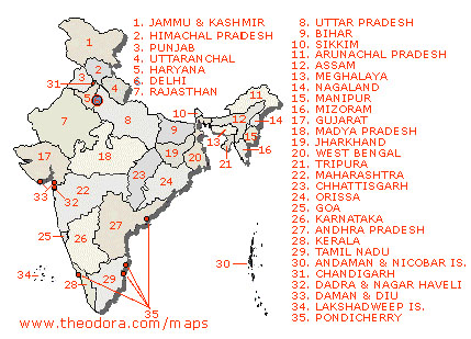
States and Union territories: (Total No.of states:28 and 7 Union territories). The states are Andhra Pradesh, Arunachal Pradesh, Assam, Bihar, Chattisgargh, Goa, Gujarat, Haryana Himachal Pradesh, Jammu & Kashmir, Jharkand, Karnataka, Kerala, Madhya Pradesh, Maharashtra, Manipur, Meghalaya, Mizoram, Nagaland, Orissa, Punjab Rajasthan, Sikkim, Tamil Nadu and Tripura, Uttranchal, Uttar Pradesh and West Bengal. The union territories are: Andaman & Nicobar Islands, Chandigarh, Dadra & Nagar Haveli, Daman & Diu, Delhi, Lakshadweep and Pondicherry.
The Capital: New Delhi
Highest Mountain/peak: Himalayas, at the northernmost part of India. These ranges form a 2,500 Km long partition between India and the rest of Asia. The tallest peak is Kanchenjunga (8598 m).
Rivers: Major rivers are the Brahmaputra , the longest, Ganga, Yamuna, Narmada, Kaveri, Krishna and Godavari.
Natural resources: Coal, iron ore, manganese, mica, bauxite, titanium ore, chromite, natural gas, diamonds, petroleum and limestone.
Major Crops: Rice, wheat, cotton, jute, coffee, tea, rubber, sugar cane and spices
SOURCES:
http://tourismofindia.com, http://indiaserver.com, http://www.journeymart.com
http://www.geographic.org/maps/india_maps.html
INTERESTING LINKS:
http://www.cia.gov/cia/publications/factbook/geos/in.html
http://www.censusindia.net/results/eci11_page4.html